


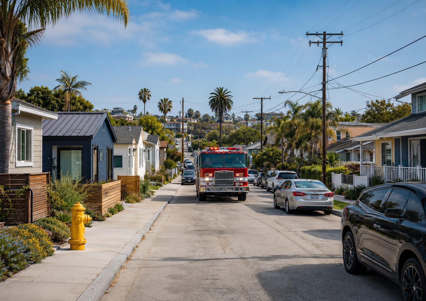
Housing policy is often discussed in terms of units: how many homes a community needs, how quickly they can be approved, how much they cost, and where additional density should occur. Those are essential questions. But they are not the only questions. The relationship between housing density and emergency access deserves greater attention as communities work to expand housing while maintaining safe, resilient, and functional neighborhoods.
Every new dwelling also becomes part of a larger operational system.
It adds residents who depend on water, electricity, sanitation, transportation, emergency medical services, fire protection, communications, and—in some circumstances—evacuation assistance. It may add vehicles to a street network, increase demand on aging utility systems, or place additional people within an area that has limited points of ingress and egress.
None of these realities are arguments against housing production. They are arguments for planning housing and infrastructure as parts of the same system.
My work across land-use planning, housing policy, public safety, and emergency management has reinforced a principle that is sometimes lost in debates over density: the public-safety question is not simply how many people live in a neighborhood, but whether the systems serving that neighborhood remain capable of functioning when conditions are at their worst.
A street that functions adequately on an ordinary Tuesday afternoon may operate very differently when fire apparatus, evacuating residents, utility crews, and incoming emergency resources all need access at the same time.
That is the hidden public-safety dimension of density.
Housing Policy Is Also Systems Policy
California has made accessory dwelling units, or ADUs, an increasingly important part of its strategy for expanding housing opportunities within existing neighborhoods. State law now significantly limits the discretion local governments may exercise over qualifying ADUs. Permit applications must be considered ministerially, without discretionary review or a hearing, and completed applications involving lots with existing single-family or multifamily dwellings generally must be approved or denied within 60 days (Cal. Gov. Code § 66317; California Department of Housing and Community Development [HCD], 2026).
Those reforms serve an important public purpose. California needs more housing, and unpredictable or unnecessarily burdensome approval processes can prevent relatively modest additions to the housing supply.
But streamlined approval does not eliminate the need for comprehensive planning. It changes where much of that planning must occur.
California law itself recognizes a relationship between ADU development and infrastructure conditions. Government Code section 66314 permits a local ADU ordinance to designate areas based on the adequacy of water and sewer services and the impacts of ADUs on traffic flow and public safety. That authority is not unlimited, however. Section 66323 separately requires ministerial approval of specified categories of ADUs notwithstanding sections 66314 through 66322 and prohibits local governments from imposing additional development or design standards that the statute does not authorize (Cal. Gov. Code §§ 66314, 66323).
That distinction matters.
The question is not whether infrastructure concerns should become a new discretionary veto over housing that state law requires local governments to permit. They should not. The more productive question is whether communities are making the parallel public investments necessary to ensure that housing growth and neighborhood resilience advance together.
When project-level discretion is constrained, long-range planning becomes even more important. General plans, capital improvement programs, utility master plans, transportation planning, hazard mitigation plans, and emergency operations plans must increasingly anticipate the cumulative effects of growth before individual projects arrive at the permit counter.
One ADU may have little measurable effect on a neighborhood. But dozens of ADUs, additional multifamily development, lot intensification, and redevelopment occurring within the same constrained infrastructure network may create a different operating environment.
Good planning must be capable of seeing both scales.
Street Width Is Not the Same as Emergency Access
Discussions about emergency access can quickly become oversimplified into an argument that wider streets are always safer.
They are not.
The U.S. Environmental Protection Agency has noted that residential street design requires balancing traffic speed, volume, parking, safety, and emergency access. In appropriate low-volume residential settings, narrower streets can accommodate emergency vehicles when they are properly designed, while connected street networks, parking controls near intersections, and other design strategies can help address competing operational needs (U.S. Environmental Protection Agency [EPA], 2021).
The real issue is therefore not simply the width shown on a subdivision map.
It is the effective operating environment.
A roadway may technically meet a dimensional standard but function differently once vehicles are parked on both sides, delivery trucks are present, vegetation encroaches into the travel way, construction activity narrows access, or drivers block turning movements at intersections.
That distinction becomes increasingly important as neighborhoods add housing incrementally.
Can fire apparatus reach structures when curb space is heavily occupied? Can emergency vehicles maneuver through intersections and dead ends? Are hydrants accessible? Can vehicles move in opposite directions during an evacuation and emergency response? Do gates, bridges, cul-de-sacs, alleys, or single-access neighborhoods create points of failure?
Those are operational questions, not arguments for reflexively widening every residential street.
Their answers require collaboration among planners, engineers, fire officials, law enforcement, public works departments, utility providers, developers, transportation professionals, and emergency managers.
Density itself is not the problem.
Unexamined operational constraints are.
Parking Is Also a Curb-Management Issue
Parking demonstrates the complexity of connecting housing policy with emergency access.
California generally limits the amount of parking that may be required for an ADU and prohibits ADU parking requirements entirely in specified circumstances, including when a unit is within one-half mile walking distance of public transit, is created within qualifying existing space, or meets other statutory conditions. State law also prohibits a local agency from requiring replacement of off-street parking spaces when a garage, carport, covered parking structure, or uncovered parking space is demolished in conjunction with ADU construction or converted into an ADU (Cal. Gov. Code §§ 66314, 66322).
Those provisions are intended to prevent parking mandates from becoming barriers to housing production.
But eliminating an off-street parking requirement does not necessarily eliminate vehicle ownership or curb demand in every neighborhood.
That does not mean parking concerns should become a proxy for opposing housing.
It means communities need to become better at curb management.
In neighborhoods experiencing substantial incremental growth, local agencies should understand how the public right-of-way is actually functioning. Are vehicles routinely reducing usable roadway width? Are hydrants, corners, or emergency access points being obstructed? Are delivery and loading activities creating predictable conflicts? Are certain streets becoming informal storage areas for vehicles in ways that affect emergency operations?
Potential responses may include targeted parking restrictions, intersection daylighting, designated loading areas, enforcement around hydrants and emergency access points, improved pedestrian connections, transit investments, or other transportation-demand strategies.
These measures address the operation of the public realm without attempting to impose parking conditions on individual housing projects that state law does not permit.
That is an important distinction.
The policy goal should be to manage streets as public infrastructure rather than treating every curb space as either an unlimited private parking resource or a problem that housing applicants alone must solve.
How Housing Density and Emergency Access Shape Evacuation
Emergency access is usually discussed in terms of getting first responders into a neighborhood.
Resilience also depends on getting residents out.
Evacuation is fundamentally a network problem.
Cova and Johnson’s microsimulation research demonstrated how a proposed second access road could change household evacuation travel times across different parts of a fire-prone community. The study illustrates why route connectivity and redundancy deserve consideration alongside roadway dimensions when evaluating neighborhood evacuation capacity (Cova & Johnson, 2002).
California-specific research reinforces this point. A 2024 transportation study collected evacuation-route information for 190 California cities and found that only 23 had comprehensive GIS evacuation maps. The researchers also analyzed road-network performance and hazard exposure across 450 cities, examining connectivity, risk, potential bottlenecks, and evacuation conditions (Jaller et al., 2024).
The implication for housing policy is significant.
Adding population does not automatically make a neighborhood unsafe. But substantial population growth within an area that has limited exits, hazard-exposed roadways, known bottlenecks, or little network redundancy may increase the consequences of an emergency if transportation and evacuation capacity are not considered at the same time.
This analysis must also extend beyond private automobiles.
An evacuation strategy that assumes every resident has a vehicle, can drive independently, and can leave without assistance is not a complete evacuation strategy. National emergency-planning guidance identifies residents with limited or no transportation access, as well as those requiring additional assistance, as populations that must be accounted for in evacuation planning. NIST likewise emphasizes community-level pre-incident assessment and evacuation planning, including preparation for fast-moving or no-notice incidents (Maranghides & Link, 2025).
Housing growth should therefore prompt a parallel conversation about evacuation demand, transportation assistance, warning systems, roadway redundancy, and the ability of the surrounding network to function under stress.
Again, the question is not whether a particular home should be prohibited because an emergency could someday occur.
The question is whether the community is preparing its systems for the population it is planning to accommodate.
Utilities Are Public-Safety Infrastructure
Infrastructure capacity is sometimes treated as a secondary technical matter to be resolved after housing decisions are made.
That approach misunderstands the relationship between infrastructure and resilience.
Water systems support household consumption, sanitation, and fire suppression. Electrical systems support refrigeration, medical devices, communications, cooling, and increasingly transportation. Sewer systems protect public health. Telecommunications systems carry emergency alerts and connect residents to public-safety resources.
A housing unit is therefore connected to multiple systems whose failure can transform an ordinary service interruption into a larger community emergency.
California law appropriately distinguishes between the financial treatment of an individual ADU and the physical capacity of the infrastructure system serving it.
Under Government Code section 66311.5, an ADU or junior ADU generally is not considered a new residential use for purposes of calculating utility connection fees or capacity charges unless it is constructed with a new single-family dwelling. Certain qualifying units also cannot be required to establish a new or separate utility connection, while other ADUs may be required to do so subject to proportionate charges tied to the burden imposed on the system. The statute separately regulates impact fees, including protections for smaller ADUs and JADUs (Cal. Gov. Code § 66311.5).
Those rules govern what agencies may require or charge individual applicants.
They do not make the underlying engineering question of system capacity disappear.
A single additional dwelling may have negligible effects on a water main, sewer line, electrical circuit, transformer, or communications network. Incremental growth repeated across hundreds of properties within the same service area may produce a different cumulative demand.
This is precisely why infrastructure planning cannot depend exclusively on project-by-project review.
Local governments and utility providers need the ability to identify where housing growth is accumulating and compare that growth with the condition, capacity, age, redundancy, and planned replacement of the systems serving those neighborhoods.
The answer should not be to stop housing wherever infrastructure is aging.
In many communities, new growth may instead strengthen the case for long-overdue infrastructure investment.
That is what responsible urban development should seek to achieve: housing production and infrastructure investment advancing together.
The Cumulative-Impact Problem of Incremental Density
Much of housing regulation operates at the level of the individual parcel.
Public safety often operates at a different scale.
A fire engine travels through a transportation network, not a zoning parcel.
An evacuation moves through neighborhoods and regional corridors.
Water pressure depends on a distribution system.
Electrical failures can affect entire circuits.
Traffic congestion emerges from accumulated activity.
Emergency services respond to population patterns across communities rather than evaluating one property at a time.
This creates what might be called the cumulative-impact problem of incremental density.
Each individual housing decision may be entirely reasonable and legally entitled to approval. Yet the combined effect of hundreds of individually reasonable decisions can change a neighborhood’s population, vehicle activity, infrastructure demand, service needs, and emergency operating environment.
Recognizing that cumulative change does not require returning to discretionary project review.
It requires better data and better long-range planning.
A community experiencing significant housing growth might, for example, track housing production geographically alongside street-network connectivity, evacuation constraints, infrastructure condition, utility capacity, transit availability, planned capital improvements, and the location of populations that may require additional assistance during emergencies.
Such analysis should not become another permit layer for homeowners.
Its purpose should be to tell policymakers something the individual building permit cannot: where public investment needs to catch up with growth.
Density and Resilience Are Not Opposing Goals
The conversation about housing and public safety is often pulled toward two unproductive extremes.
One position may invoke parking, traffic, infrastructure, or fire access as reasons additional housing should not be built.
The other may treat nearly every discussion of infrastructure or emergency access as disguised resistance to growth.
Neither approach fully reflects the responsibility of good planning.
Infrastructure concerns should not be weaponized to recreate discretionary barriers that California housing law has deliberately removed. At the same time, emergency access, evacuation capability, water reliability, transportation networks, and utility resilience are legitimate governmental responsibilities.
The solution is not to choose one responsibility over the other.
It is to plan for both.
A resilient housing strategy should anticipate operational capacity before a crisis exposes its weaknesses. It should monitor cumulative neighborhood change rather than relying entirely on individual project review. It should preserve emergency access through thoughtful street and curb management rather than assuming that wider roads are always the answer. It should incorporate evacuation planning into long-range land-use decisions, especially in hazard-exposed areas. And it should connect housing growth with capital improvement planning so that public infrastructure evolves with the population it is expected to serve.
Most importantly, communities should stop thinking about housing units as isolated physical structures.
Every housing unit becomes part of a neighborhood.
Every neighborhood depends on infrastructure.
And every infrastructure system eventually faces conditions under which normal operations become difficult.
The measure of resilience is what happens then.
Planning for the Day the System Is Under Stress
Responsible housing policy asks where people will live.
Resilient housing policy asks another question:
What will those residents need when the community is under stress?
Can emergency responders reach them?
Can residents evacuate when necessary?
Can people without access to transportation receive assistance?
Will critical streets remain passable?
Can water systems support community demand and emergency operations?
Can electrical and communications networks continue serving a growing population during extreme heat, wildfire, earthquakes, or prolonged outages?
Where are the single points of failure—and what investments can eliminate them before the emergency occurs?
These questions should not be used to delay desperately needed housing.
They should be used to build better communities around it.
California’s housing laws have made clear that local governments cannot rely on traditional discretionary processes to reconsider every individual ADU as though it were a major development project. That reality makes strategic planning more important, not less. Housing policy, infrastructure planning, emergency management, and capital investment must increasingly operate as connected disciplines rather than separate governmental functions.
The future of urban development should not be framed as a choice between growth and public safety.
Properly understood, the two are inseparable.
Housing production must be planned alongside emergency access and infrastructure capacity because resilience is not created by limiting how many people can live in a community. It is created by ensuring that the systems supporting those people are prepared to serve them—especially on the day when those systems are needed most.
References
California Department of Housing and Community Development. (2026). Accessory Dwelling Unit Handbook. Updated March 2026.
California Government Code § 66311.5. Accessory dwelling unit and junior accessory dwelling unit fees, utility connections, and capacity charges.
California Government Code § 66314. Local accessory dwelling unit ordinances and development standards.
California Government Code § 66317. Ministerial review and approval of accessory dwelling unit applications.
California Government Code § 66322. Accessory dwelling unit parking standards and specified protections.
California Government Code § 66323. State-mandated ministerial approval of specified accessory dwelling units.
Cova, T. J., & Johnson, J. P. (2002). Microsimulation of neighborhood evacuations in the urban–wildland interface. Environment and Planning A, 34(12), 2211–2229. https://doi.org/10.1068/a34251
Jaller, M., Thorne, J. H., Rivera-Royero, D., Whitney, J., Hu, A. K., & Saha, A. (2024). Improving public safety through spatial synthesis, mapping, modeling, and performance analysis of emergency evacuation routes in California localities. National Center for Sustainable Transportation. https://doi.org/10.7922/G27D2SG5
Maranghides, A., & Link, E. (2025). WUI fire evacuation and sheltering considerations: Assessment, planning, and execution (ESCAPE) (NIST Technical Note 2262r1). National Institute of Standards and Technology. https://doi.org/10.6028/NIST.TN.2262r1
U.S. Environmental Protection Agency. (2021). Right-sized residential streets: Stormwater best management practice (EPA-832-F-21-031U).
Federal Emergency Management Agency. Planning considerations: Evacuation and shelter-in-place.

Leave a Reply
You must belogged in to post a comment.